- Practical GIS
- Gábor Farkas
- 264字
- 2021-07-02 22:49:12
Rasters are boring
To put it simply--absolutely not. Well, maybe in QGIS a little bit, but rasters have potential far beyond the needs of an average GIS analysis. First of all, rasters do not need to be in two-dimensional space. There are 3D rasters called voxels, which can be analyzed in their volume or cut to slices, visualized in a whole, in slices, or as isosurfaces for various values (Appendix 1.1).
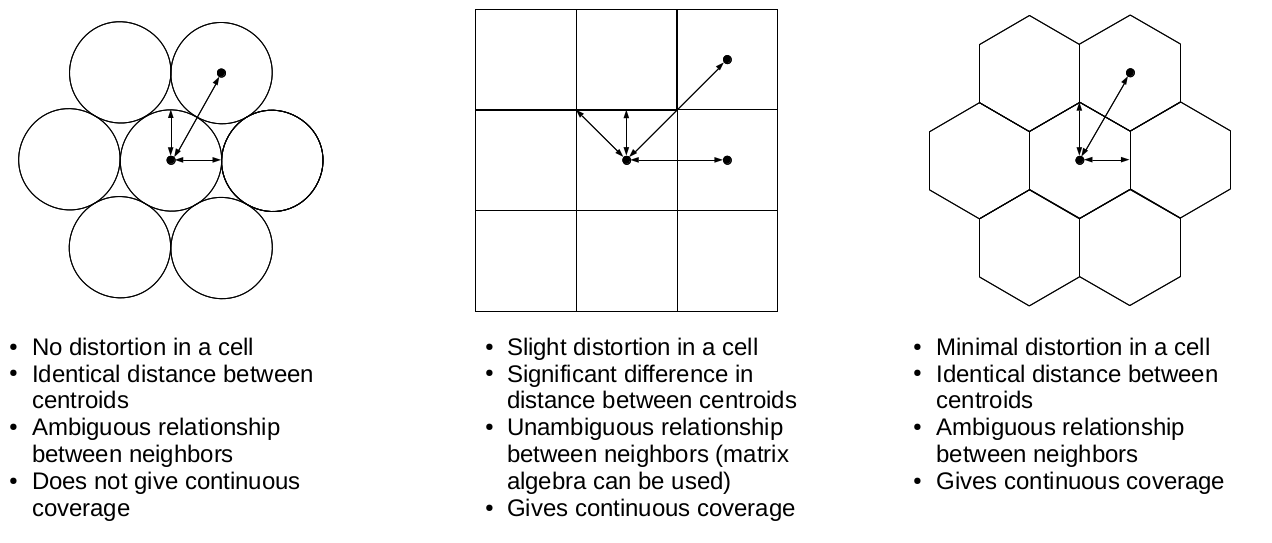
Furthermore, cells don't have to be squares. It is common practice to have different resolutions in different dimensions. Rasters with rectangular cells are supported by QGIS, and many other open source GIS clients. Rasters don't even need to have four sides. The distortions (we can call it sampling bias in some cases, mostly in statistics) caused by four-sided raster cells can be minimized with hexagons, regular shapes with the most sides capable of a complete coverage:
Okay, but can rasters only store a single thematic? No, rasters can have multiple bands, and we can even combine them to create RGB visualizations. Finally, as we contradicted almost every rule of the raster data model, do individual cells need to coincide (have the same resolution)? Well, technically, yes, but guess what? There are studies about a multi-resolution image format, which can store rasters with different sizes in the same layer. It's now only a matter of professional and business interest to create that format.
- Visual Basic 6.0程序設計計算機組裝與維修
- Scratch真好玩:教小孩學編程
- Silverlight魔幻銀燈
- 微信小程序入門指南
- Android程序設計基礎
- 運用后端技術處理業(yè)務邏輯(藍橋杯軟件大賽培訓教材-Java方向)
- HTML 5與CSS 3權威指南(第3版·上冊)
- 從零開始學C#
- 新一代SDN:VMware NSX 網(wǎng)絡原理與實踐
- Maker基地嘉年華:玩轉樂動魔盒學Scratch
- 新印象:解構UI界面設計
- Julia數(shù)據(jù)科學應用
- jQuery技術內幕:深入解析jQuery架構設計與實現(xiàn)原理
- SSH框架企業(yè)級應用實戰(zhàn)
- 深入淺出 HTTPS:從原理到實戰(zhàn)