- Grome Terrain Modeling with Ogre3D,UDK,and Unity3D
- Richard A.Hawley
- 286字
- 2021-07-30 17:32:37
Texture sizes
Using textures for heightmap information does have limitations. The largest "safe" size for a texture is considered 4096 x 4096 although some of the older 3D cards would have problems with anything higher than 2048 x 2048. Also, host 3D engines often require texture dimensions to be a power of 2. A table of recommended dimensions for images follow:
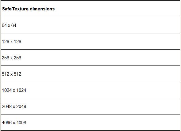
512 x 512 provides efficient trade-off between resolution and performance and is the default value for GROME operations.
If you're familiar with this already then great, you might see questions posted on forums about texture corruption or materials not looking correct. Sometimes these problems are the result of not conforming to this arrangement. Also, you'll see these numbers crop up a few times in GROME's drop-down property boxes. To avoid any potential problems it is wise to ensure any textures you use in your projects conform to these specifications. One exception is Unreal Development Kit (UDK) in which you'll see numbers such as 257 x 257 used, we'll discuss this in Chapter 7, Exporting to Unity, UDK, and Ogre 3D.
If you have a huge amount of terrain data that you need to import for a project you can use the texture formats mentioned earlier but I recommend using RAW formats if possible. If your project is based on real-world topography then importing DTED or GeoTIFF data will extract geographical information such as latitude, longitude, and number of arc seconds represented by the terrain.
- Dreamweaver CS3網(wǎng)頁制作融會貫通
- 圖解PLC控制系統(tǒng)梯形圖和語句表
- 大數(shù)據(jù)技術(shù)入門(第2版)
- 四向穿梭式自動化密集倉儲系統(tǒng)的設(shè)計與控制
- Linux Shell編程從初學(xué)到精通
- Visual Studio 2010 (C#) Windows數(shù)據(jù)庫項目開發(fā)
- ASP.NET 2.0 Web開發(fā)入門指南
- 電腦上網(wǎng)入門
- 三菱FX/Q系列PLC工程實例詳解
- 簡明學(xué)中文版Photoshop
- WOW!Photoshop CS6完全自學(xué)寶典
- 電腦故障排除與維護終極技巧金典
- 手把手教你學(xué)Flash CS3
- 新一代人工智能與語音識別
- 系統(tǒng)建模與控制導(dǎo)論