- Spatial Analytics with ArcGIS
- Eric Pimpler
- 187字
- 2021-07-02 23:38:49
Running the Median Center tool
The Median Center tool identifies the location from a feature class that minimizes the overall Euclidean distance to the features in a dataset. Unlike the Mean Center tool, the Median Center tool is not as affected by outliers.
Let's take a look at the following steps to run the Median Center tool:
- If necessary, open ArcToolbox and look for the Spatial Statistics Tools toolbox. Open the toolbox and expand the Measuring Geographic Distributions toolset. Double-click on Median Center to display the tool, as shown in the following screenshot:

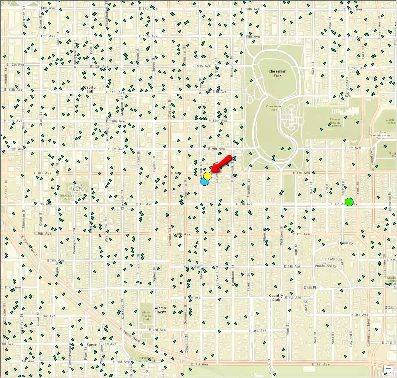
- Select Denver Burglary as the Input Feature Class and C:\GeospatialTraining\SpatialStats\Data\crime.gdb\Burglary_MedianCenter as the Output Feature Class. Click on the OK button. The output feature class will contain a single point location, as shown in the following screenshot. In this case, we have continued to display the points generated by the Central Feature and Mean Center tools that we ran in the last section so that you can see the difference. In this case, the Median Center tool is almost exactly the same as the Central Feature tool:
- Save the map document file before exiting ArcMap.
推薦閱讀
- 高效能辦公必修課:Word圖文處理
- 大數(shù)據(jù)導(dǎo)論:思維、技術(shù)與應(yīng)用
- 面向STEM的mBlock智能機(jī)器人創(chuàng)新課程
- 精通Windows Vista必讀
- 機(jī)器自動(dòng)化控制器原理與應(yīng)用
- 自動(dòng)生產(chǎn)線的拆裝與調(diào)試
- Learning C for Arduino
- 大學(xué)C/C++語(yǔ)言程序設(shè)計(jì)基礎(chǔ)
- 人工智能技術(shù)入門(mén)
- Learn QGIS
- Excel 2007終極技巧金典
- 機(jī)器人制作入門(mén)(第4版)
- Deep Learning Essentials
- 系統(tǒng)安裝、維護(hù)與數(shù)據(jù)備份技巧
- 暗戰(zhàn)強(qiáng)人:黑客及反黑客工具快速精通